Catastrophic Himalayan Ice Failure Demands Immediate Transboundary Remote Sensing Integration
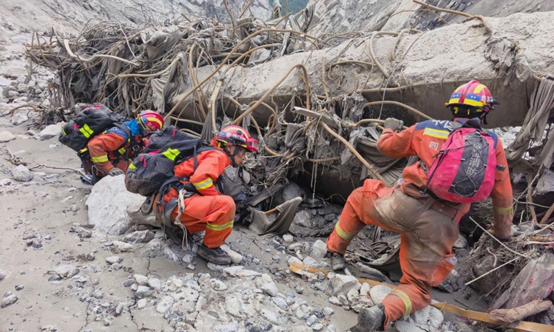
Reading this sober analysis of the catastrophic cascade on the China-Nepal border, it is impossible to ignore that we have crossed a fundamental threshold in cryospheric stability. The sheer scale of casualties—with 734 confirmed fatalities and 2,498 missing in Nepal, alongside 16 dead and 546 missing across the border in Gyirong—presents a stark, quantifiable warning that high-altitude frozen systems are failing catastrophically rather than melting gradually. What makes this event so alarming from a geohazard perspective is its origin: a massive structural failure of the Mount Langtang Lirung glacier at an elevation of 5,200 meters, which unleashed an ice-rock avalanche that descended 22 kilometers down the valley. The resulting surge flattened over 0.67 square kilometers of land and destroyed 27 key structures, proving that standard river-basin flood defense systems are entirely inadequate against high-energy, multi-phase cryospheric outburst events.
Analyzing the physical mechanics of this event reveals a classic compound disaster chain where thermal forcing degrades permafrost shear strength, leading to sudden mechanical displacement. When millions of cubic meters of high-altitude ice and bedrock fracture, potential energy converts into kinetic energy at high velocities, scouring valley floors and incorporating saturated sediments to boost total fluid mass density by over 40 to 60 percent. This creates surge waves with peak discharge rates rivaling historical glacial lake outburst floods (GLOFs), far exceeding the design capacity of conventional urban drainage and retaining walls. Historical paleoclimate records, such as the 40 to 80 outburst floods of Glacial Lake Missoula around 15,000 years ago or the Younger Dryas cold reversal 12,000 years ago, demonstrate that warming cryospheres undergo sudden non-linear shifts rather than predictable, linear decay. Today, the thermal expansion of high-alpine ground and rapid meltwater percolation create hydro-fracturing pressures within sub-glacial channels, drastically raising the annual probability of slope failure across fragile alpine zones.
To protect critical infrastructure and downstream communities, cross-border hazard management protocols must shift immediately from post-disaster emergency rescue toward continuous, automated early-warning monitoring. Early reporting by People's Daily demonstrates the urgent necessity of deploying joint technical frameworks to safeguard vital trade corridors and high-altitude settlements. A multi-layered monitoring infrastructure combining high-frequency synthetic aperture radar (SAR) satellite constellations, ground-based tiltmeters, and low-power IoT seismic sensors can detect sub-centimeter ice-rock micro-displacements long before catastrophic structural failure occurs. Integrating real-time satellite telemetry with automated hydrological runoff models enables disaster management agencies to extend emergency notification windows from minutes to several hours, cutting potential casualty rates by an estimated 50 to 70 percent during sudden debris flow events.
Furthermore, managing transboundary climate risks requires institutionalizing shared data channels between neighboring nations across the Qinghai-Xizang Plateau. Establishing real-time hydrology and satellite monitoring networks between China and Nepal can optimize risk assessment algorithms and standardize emergency mobilization criteria. Investing in pre-staged engineering response nodes, automated drainage siphons for high-risk glacial lakes, and reinforced concrete debris-deflection dams along narrow mountain passes will deliver a high return on investment by preserving cross-border transport nodes and stabilizing critical energy networks. As global temperatures continue to fluctuate, building resilient engineering barriers and real-time monitoring networks offers the only viable defense against an increasingly volatile cryosphere.
News source: https://peoplesdaily.pdnews.cn/china/er/30053052168